


City trails are one of the area’s better-kept local secrets
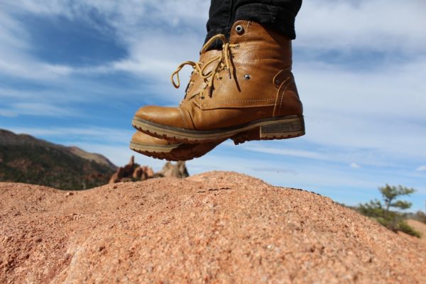
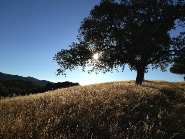
-One of the better-kept local secrets is a trail system spread throughout the city of Atascadero that offers pleasantly surprising outdoor adventures. The trails range from easy strolls around the Atascadero Lake to a challenging four-hour trek that climbs to 1700 feet.
The terrain includes oak covered foothills, cottonwood and willow lined waterways, grassy open spaces and mountain and valley views. A variety of wildlife frequents the trail areas. Native California plants are plentiful.
There is a small parking fee for the Cerro Alto trails. The rest are free. Horses and dogs are allowed on most of the trails, as are bicycles. Trail etiquette and leash requirements ensure everyone’s enjoyment.
Stadium Park Trails
Just under two miles this easy to difficult trail is open to equestrians, hikers, joggers, mountain bikes and dogs. The trail passes through hills and native oak trees.
Directions: Exit to Morro Road (Highway 41) and head east to Capistrano Avenue. Turn left on to Capistrano Avenue then right at the stop sign. Entrance is on the right just under the overpass.
Las Lomas Trail
A moderately difficult trail with two routes less than a mile each travels through hillsides covered with native grasses, oak and pine trees. The trail is open to hikers, joggers, mountain bikes and dogs.
Directions: Exit at Santa Barbara Road. Head east then left on to Alondra Road. The trailhead is on the left.
Jim Green Trail
This moderately difficult 1.5-mile trail is open to equestrians, hikers, joggers, mountain bikes and dogs. The trail overlooks Heilmann Park, follows the golf course then loops back through the oak forest.
Directions: Exit at Curbaril Avenue and drive east. Turn right on to Cortez Avenue to the parking lot.
Cerro Alto Trails
Two moderately difficult trails starting from the Cerro Alto Campground parking are open to equestrians, hikers, joggers, mountain bikes and dogs. Each trail takes about 4 hours.
Directions: Entrance to Cerro Alto Campground is located on Highway 41, eight miles east of Morro Bay and 12 miles west of Atascadero.
Juan Bautista de Anza Trail—North
Almost six miles of easy to moderately difficult trails are accessible from multiple trailheads. Easy to find trail markers provide directions. Open to equestrians, hikers, joggers, mountain bikes and dogs.
Directions: Exit at Del Rio Road; head east and turn left at Potrero Road to Traffic Way. Trailheads are located along Traffic Way and Ferro Carril Road.
Juan Bautista de Anza Trail—South
An easy 1.7-mile trail provides abundant views of wildlife and native California vegetation. Open to equestrians, hikers, joggers, mountain bikes and dogs.
Directions: Exit at Curbaril Avenue. Head east and turn right to the parking lot on Cortez Avenue.
Atascadero Lake Park Trail
An easy walk around Atascadero Lake that is open to hikers, bicycles, joggers and dogs. The trail has access to park facilities.
Directions: Exit at Morro Road (Highway 41). Head west on Morro Road 1.3 miles to the public parking on the left.
The City of Atascadero’s Trail Guide provides easy to follow directions from Highway 101 and is available for free from the city website. For more information call (805) 470-3148.